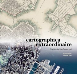
Cartographica Extraordinaire
The Historical Map Transformed
“So geographers in Afric’ maps / With savage-pictures fill their gaps; / And o’er uninhabitable downs / Place elephants for want of towns,” commented Jonathan Swift.
Cartography, that age-old science that combines beauty with utility, has long since thrown off Swift’s satirical charge. With remote-sensing systems, digital imaging, elevation modeling, and allied capabilities, the new technology of Geographic Information Systems (GIS) has come into its own; today maps for every need are only a computer keyboard away. Thankfully, the authors (Rumsey is a Yale academic turned traditional and digital cartography specialist, and Punt is a graduate of McGill University and now a prize-winning cartographic specialist and publisher) demonstrate that this development means new life for older and truly antique maps. Complete with their elegant pictorial enhancements, they can be relaunched into archives, books, and homes via the Internet.
In this visually stunning, oversized volume, Rumsey and Punt present over one hundred highly diverse maps from the late eighteenth to the early nineteenth century that illustrate advances in cartographic specialization and information display. Given GIS, old maps can be scanned, geo-rectified, and made “to unleash their content in new and exciting ways, by enabling comparison, overlay, and reformatting with modern geo-spatial data.” Thus, the computer user with a GIS program can, for example, download Captain Cook’s or La Pérouse’s partial maps of the South Seas, overlay them on modern maps, note accuracies and discrepancies, and fill in these navigators’ missing sections.
Transformation is the driving force behind the book’s ever-engaging parade of maps. They advance from recording land mass to defining its interior, which was then be accurately measured so new owners could sell off portions to settlers. Ironically, the authors note in one of many interesting asides that while the aggressive British publicized maps as “ownership deeds,” the conservative Spanish withheld them as privileged “intellectual property.” Accurate but artistic presentation of “the fuller volume of reality on flat paper” has always been a must in cartography, though depicting altitude through “crescentic hachures” or shadings is problematic; hence colors and contour lines, bird’s eye views and pictorial insets.
The book’s chronological basis frequently captures history in the making: the vital mapping achievements of Lewis and Clark, Humboldt, “the Four Great Surveyors” of the American West, and others receive due recognition. Business and finance enter the picture with the specialized canal, rail, mail route, telephone cable maps of the late eighteenth century, all intent on promoting new township settlements and revenues. A brief last chapter discusses the technologies of digital cartography, which makes maps
“dynamic and changeable.” A visual index provides source notes on the maps.
This is a superb book; the concept is original, the information important, and the presentation always engaging. Design and production are first class; faithful to the cartographic ideal, the book combines utility with beauty.
Disclosure: This article is not an endorsement, but a review. The publisher of this book provided free copies of the book to have their book reviewed by a professional reviewer. No fee was paid by the publisher for this review. Foreword Reviews only recommends books that we love. Foreword Magazine, Inc. is disclosing this in accordance with the Federal Trade Commission’s 16 CFR, Part 255.
