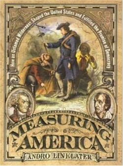
Measuring America
How an Untamed Wilderness Shaped the United States and Fulfilled the Promise of Democracy
What would the United States look like today if Thomas Jefferson’s argument to measure land according to metric units had succeeded? Would road atlases and other maps show the system of squares and grinds that so simply marks the division of land parcels, particularly west of the Ohio River?
In this fascinating history in the tradition of Dava Sobel’s Longitude, the author, who studied history at Oxford, shows how the surveying system introduced by English mathematician Edmund Gunter in 1607 prevailed over Jefferson’s system as the method by which the new wilderness beyond the Ohio River was measured. Moreover, he examines the ways that the idea of property in the emerging nation differed from the British notion of property. The differences, he contends, established the democratic view of land ownership that characterizes the United States and the more aristocratic view of property held by the British.
In seventeenth-century England, Linklater points out, the ownership of land passed from the monarchy and religious institutions such as monasteries to various wealthy individuals, and landowners began to realize that they could parcel off their land and rent it to tenants. Thus, accurate and reliable measurements of property grew increasingly important, and the land surveyor took on a new role as an agent of establishing the bounds of private property. Enter Gunter, who revolutionized the surveying business with a surveying chain that could provide mostly reliable land measurements and whose system was adopted by American land surveyors.
Land ownership in America took a very different turn, however. Linklater weaves a compelling story of the manner in which Jefferson and others used the philosophy of John Locke and the new methods of surveying to create a singularly American approach to property. Locke argued that property could belong only to the individual who was able to labor upon it. In the emerging nation, then, lands newly surveyed were sold to those farmers and setters who could work the land, and who had the money to purchase the land. Linklater contends that Jefferson opened the way for this new American view of land ownership with “three measures so substantial that they were to permeate every aspect of American life: the invention of the dollar, the procedure for creating new states from the Western Territory, and the means of surveying that territory.”
In America, Gunter’s methods of plotting land in square miles and acres triumphed over Jefferson’s metric system so that the United States looks now like a system of squares and grids. As Linklater’s tale so effectively demonstrates, the emphasis on reliable boundaries of private property remains with us even today as neighbors build fences to stake out the land that they call their own, have paid for with their own money, and work with their own hands.
Reviewed by
Henry L. Carrigan
Disclosure: This article is not an endorsement, but a review. The publisher of this book provided free copies of the book to have their book reviewed by a professional reviewer. No fee was paid by the publisher for this review. Foreword Reviews only recommends books that we love. Foreword Magazine, Inc. is disclosing this in accordance with the Federal Trade Commission’s 16 CFR, Part 255.
